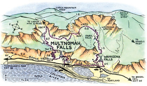
Just 30 min drive east from Portland , Oregon , this is one of the scenic area for good hikes through the lush green forests and beautiful waterfalls. To get to the hikes , you have to drive the oldest scenic highway in the US – Historic highway 30.
Horsetail Falls Trailhead
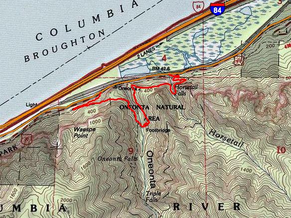
Horsetail Falls can be seen from street level, or by heading down a few steps to the rocky shoreline and plunge pool below. There are great photo-ops here, as well as a chance to dip your toes in the cool water.
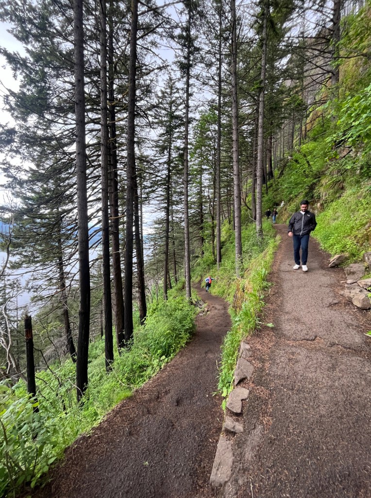
The Horsetail Falls Trail begins climbing some easily graded switchbacks with beautiful rock walls . You’ll pass your first trail junction here, where the Gorge Trail #400 heads east. After several switchbacks dotted with ferns , mosses and wildflowers , the trail levels out and heads west high above the Gorge below.
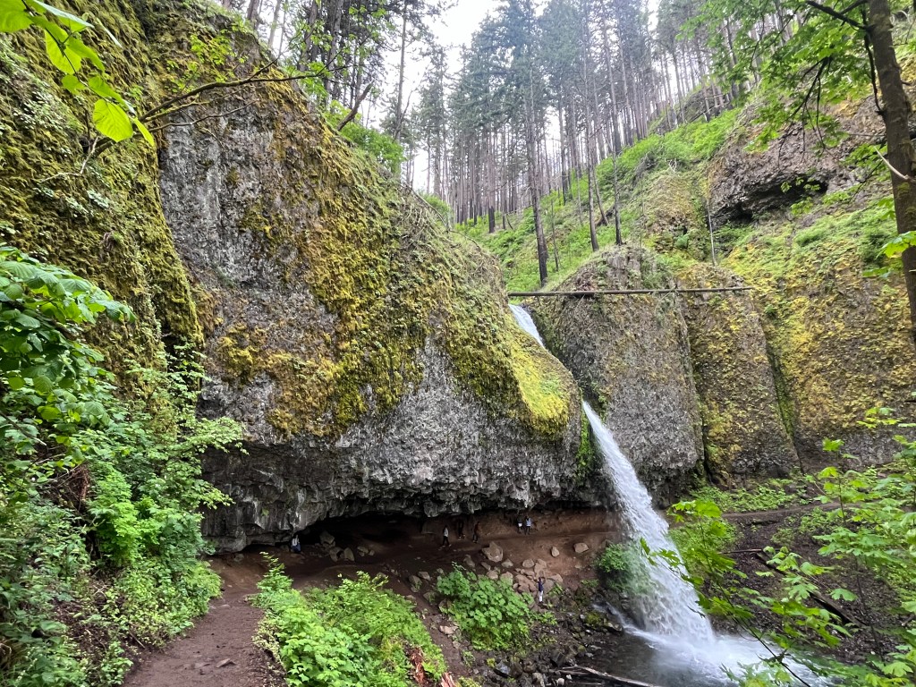
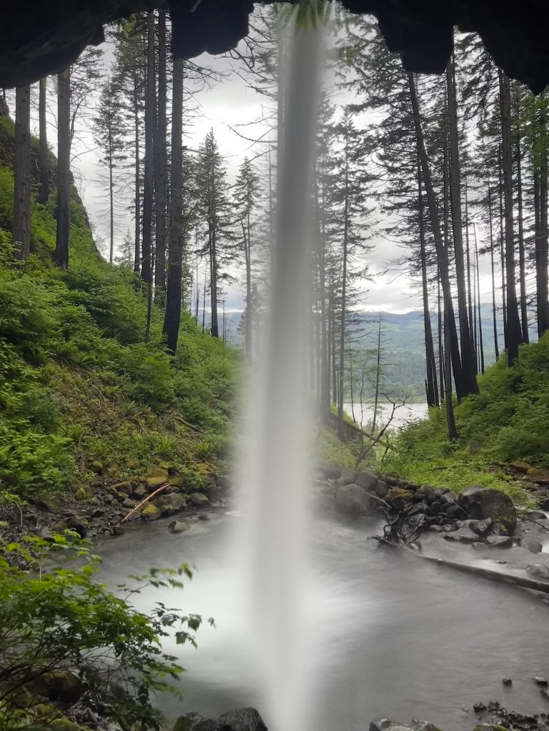
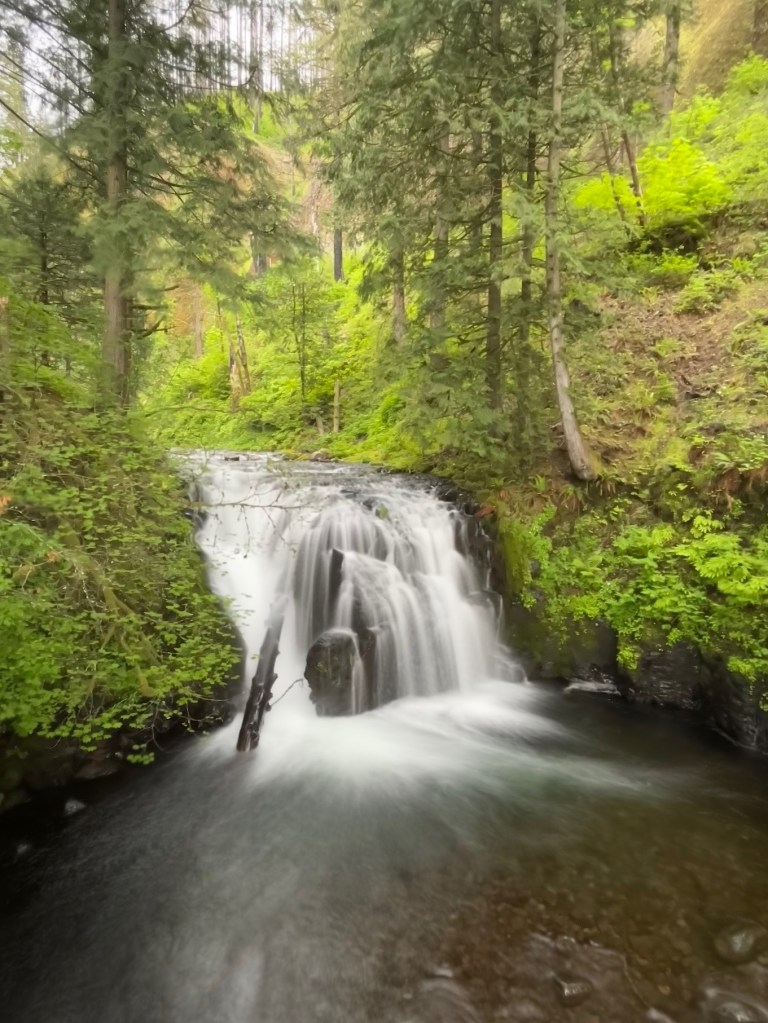
After 0.4 miles / ~30 mins , the trail suddenly turns into the small ravine containing Ponytail Falls. The trail passes behind Ponytail Falls in a cavernous overhang at a soft layer between Columbia River Basalt flows.

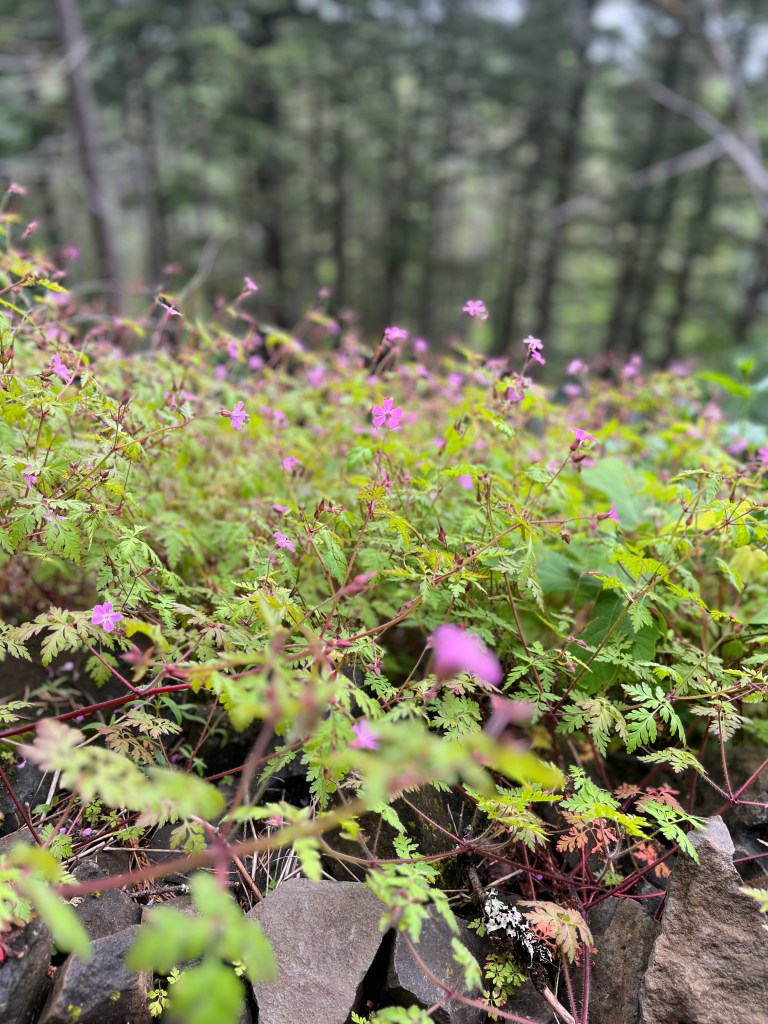
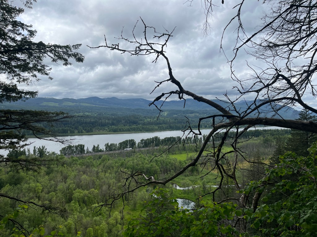
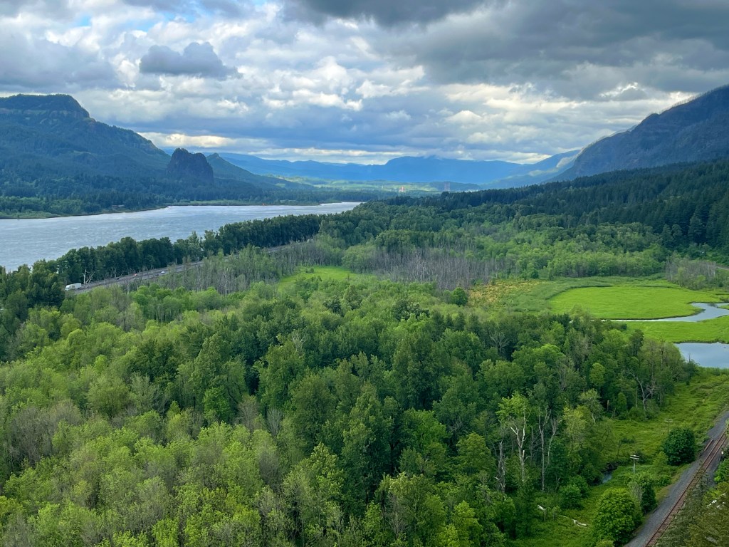
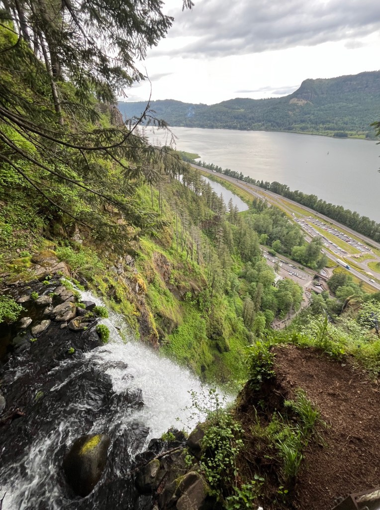
The trail continues west, maintaining a level path along the bluff. Rockfall here supports moss, ferns, and a few large maples. A side trail leads to Oneonta Bluff’s clifftop viewpoints . You will get a wonderful view of Columbia river and Beacon Rock and Hamilton mountain to the east
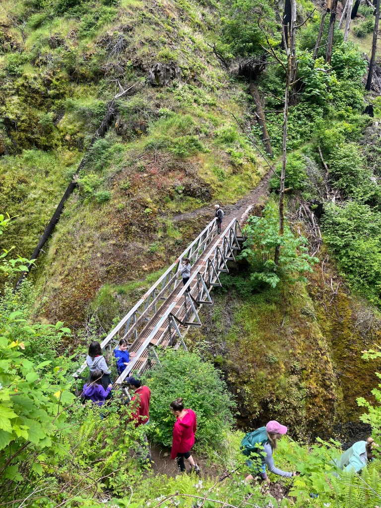
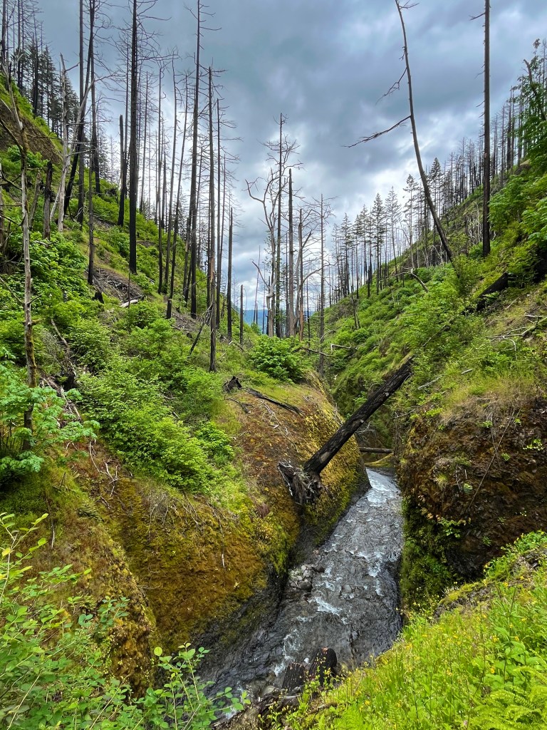
The main trail continues into Oneonta Gorge, where the 2017 Eagle Creek Fire scorched hillsides in a raging canopy fire. The trail crosses Oneonta Creek on a metal bridge, which somehow remained unscathed from the Eagle Creek Fire. Just above the bridge is Middle Oneonta Falls, a 15-foot drop. Just below the bridge, the creek disappears over the brink of Oneonta Falls into Oneonta Gorge.
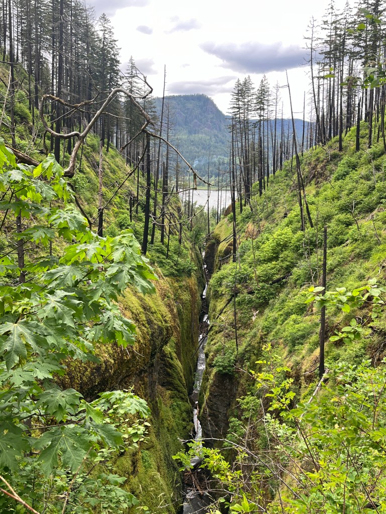

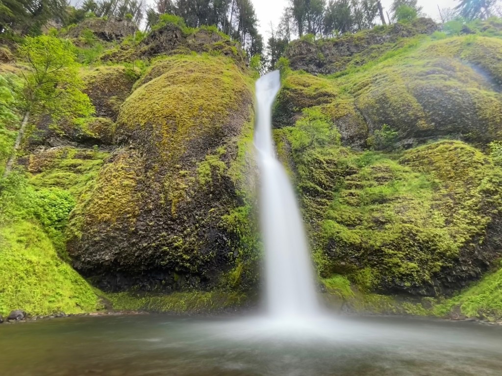
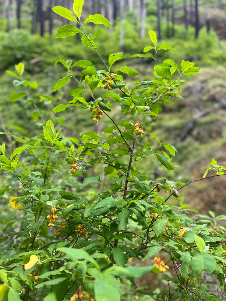
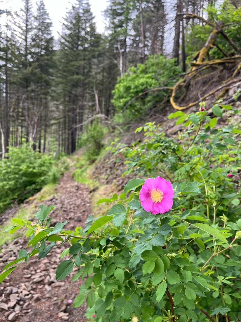
The bared slopes above Middle Oneonta Falls bloom with variety of plants in spring specially roses and indian plums .
Beyond the bridge, the trail switchbacks twice up to a junction with the Oneonta Trail #424.
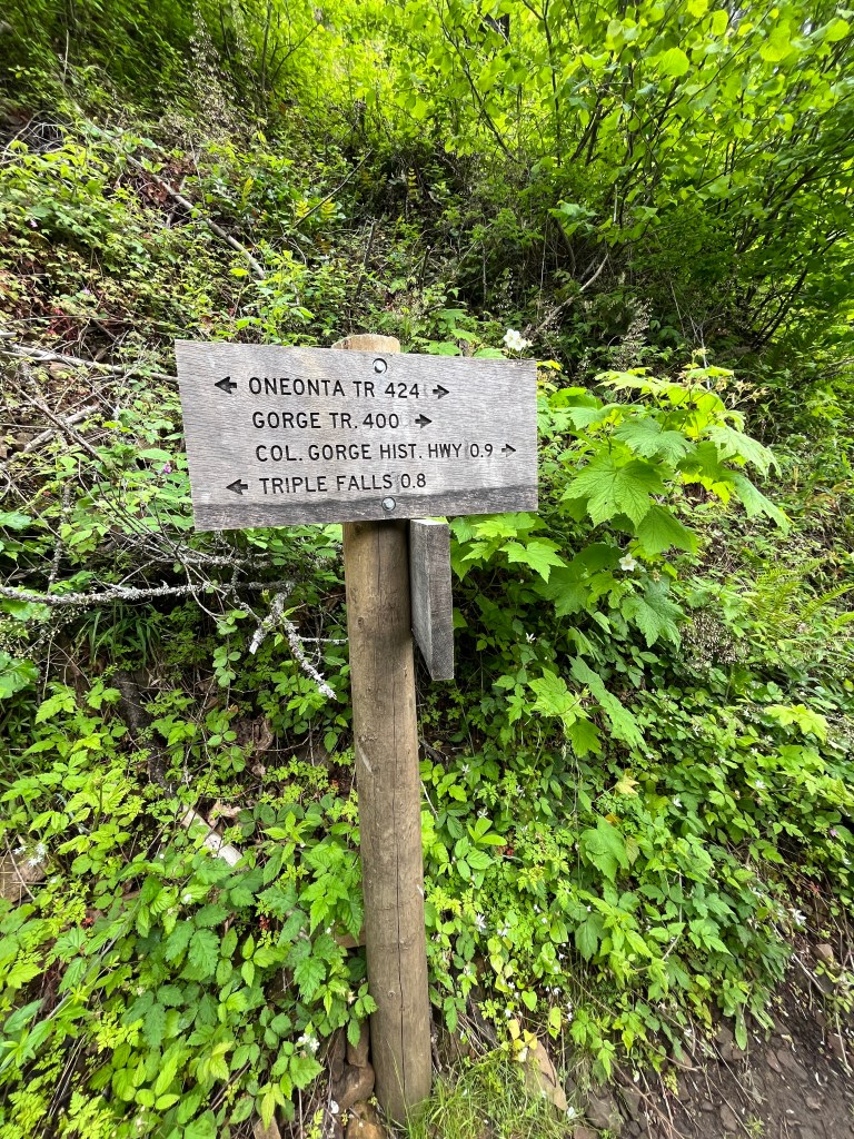
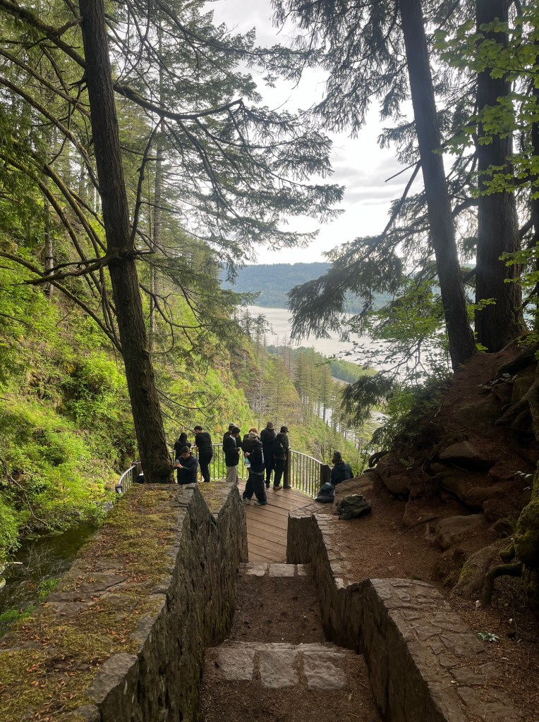
To complete the loop, turn right and head down the Oneonta Trail. Then you’ll come to another junction with the #400 trail, this time heading west toward Multnomah Falls. Turn right here to stay on the Oneonta Trail, and head down steeply to the Historic Highway, getting views of Archer Mountain across the river.
We haven’t took #400 trail to Multnomah falls, instead followed the Oneonta trail and head down to the Historic highway and drove to Multnomah falls .
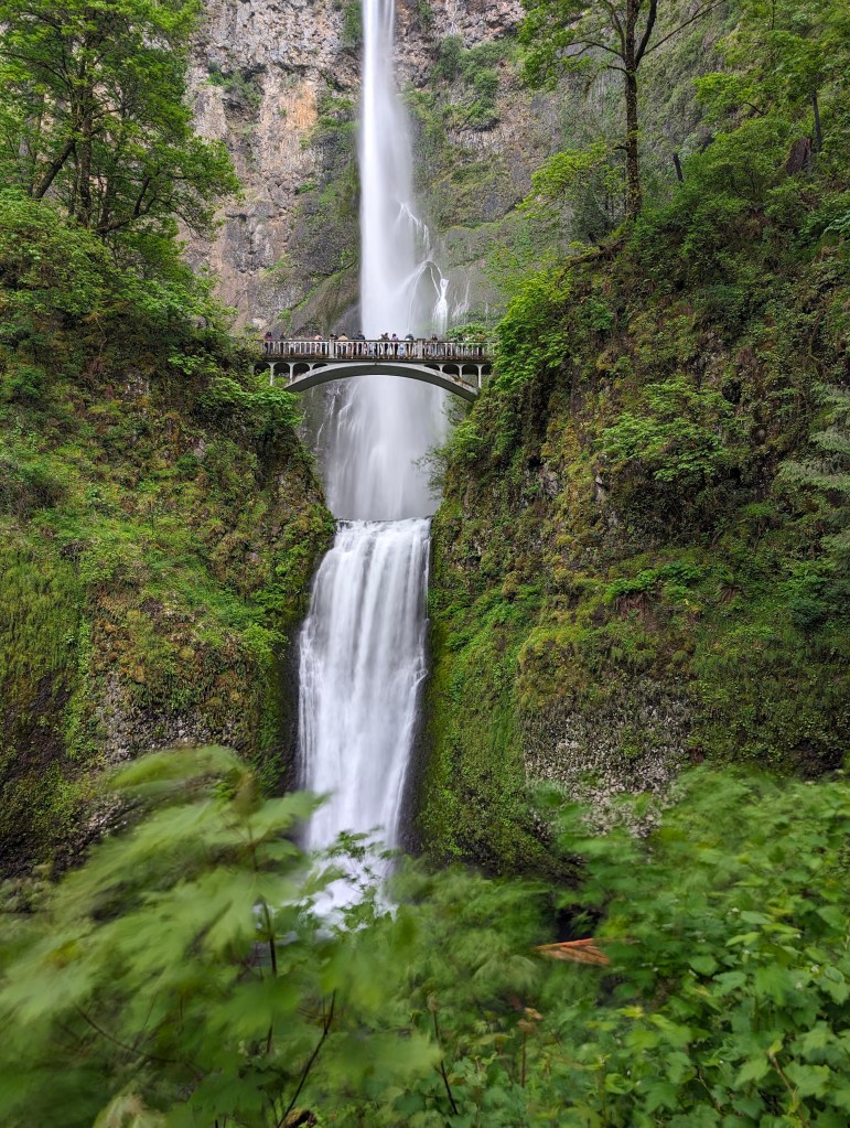
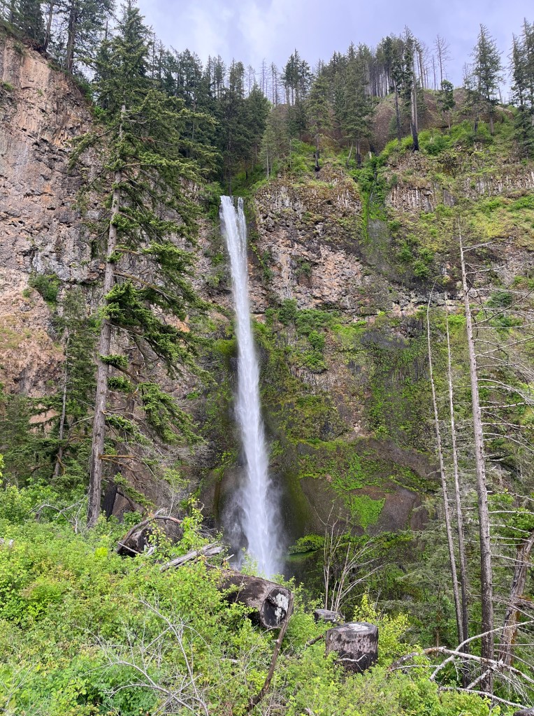
Multnomah Falls
It is also the tallest waterfall in Oregon, includes three separate drops (the upper falls, the main falls, and the lower falls) for a total of 635 feet.
This is definitely the most scenic waterfalls in all the waterfalls in this area.
The trail begins at Multnomah Falls Lodge, a historic building built to serve early automobile travelers in 1925. From a photographer’s viewpoint, get a head on vista of both the lower and main tiers of Multnomah Falls and the picturesque span of the Benson Bridge.
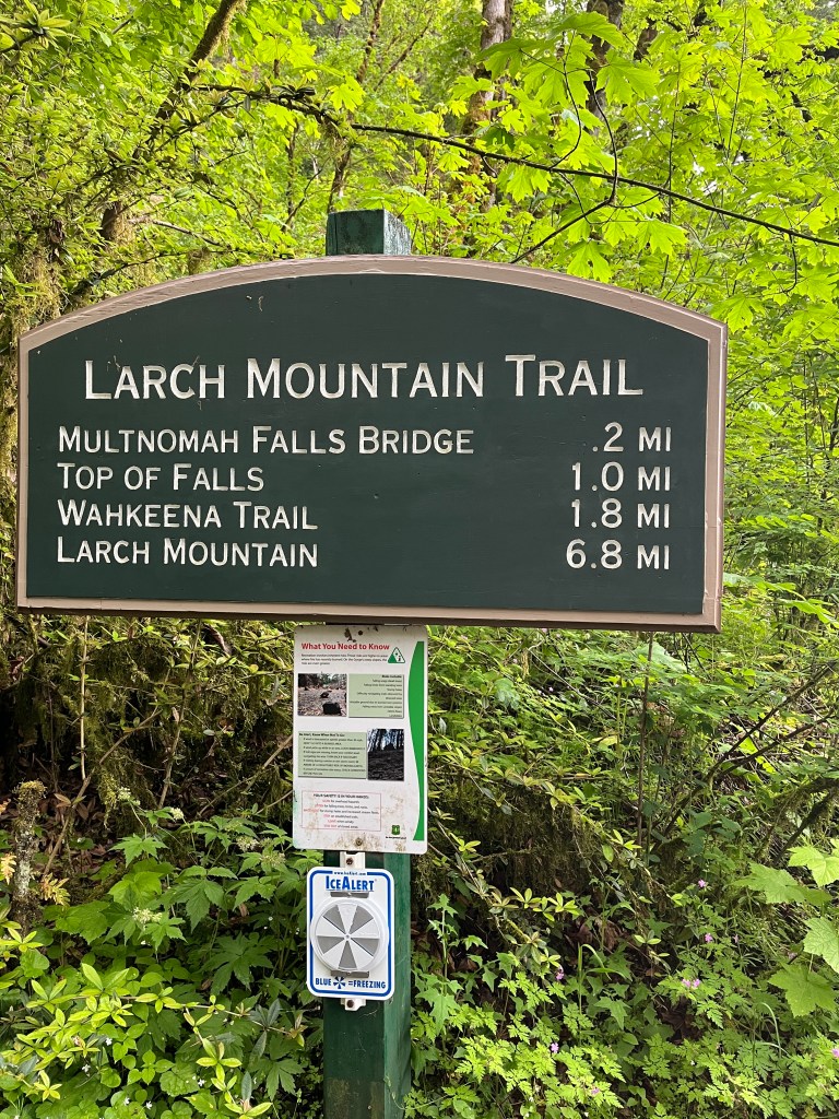
The trail is a gently sloped 0.2 mile paved path to the Benson Bridge,


Beyond the bridge, the trail switchbacks steeply uphill, with excellent Columbia River views. In 1.1 miles, turn right to the viewpoint atop the upper falls, via Multnomah Falls Overlook Spur Trail/Trail 441A.
Walk 0.1 mile to a wooden overlook that’s thrillingly close to where the upper falls begins its 542-foot drop. (The total drop is 620 feet: 69 in the lower falls, 9 feet between the falls, and 542 feet for the upper falls.)
If you’re not yet ready to turn back, consider continuing on a 5.4-mile loop to see the area’s other waterfalls. From the viewpoint at the top of Multnomah Falls, follow the Larch Mountain Trail up Multnomah Creek 0.7 mile. Then turn right on the Wahkeena Trail. This path climbs for 0.9 mile and then descends past Fairy Falls to an elegant stone bridge below Wahkeena Falls, a 242-foot triple cascade in a sculpted chute.

Leave a comment